
The atlas of Informality: Mapping the expansion of informal settlements around the world
Explore the Atlas of Informality
The Atlas of Informality is an attempt to open a window into the overlooked phenomena of informal settlements change. This database presents informal neighborhoods across the world. The Atlas maps current settlement boundaries and how those have changed historically (approximately up to 15 years before the current date).

Make sure to check out TEDx Talk "How informal settlements (slums) will reshape the world"
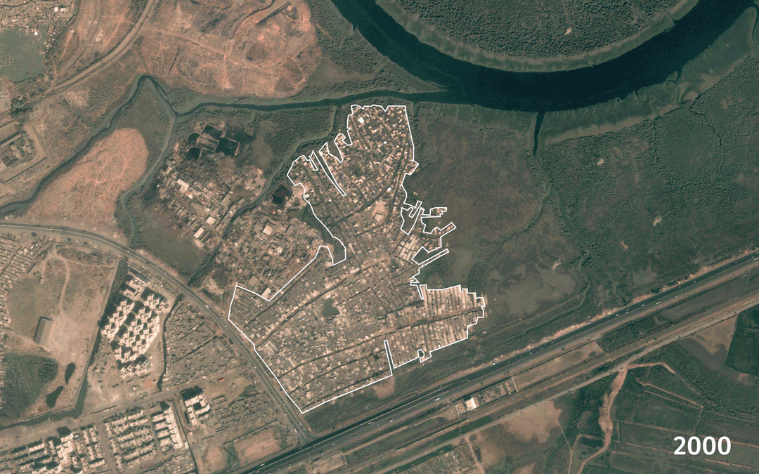
Please explore The Atlas, here we have located more than 260 informal settlements in 147 cities, 102 countries, and 5 continents across the world. Each place has two measures in time to show how it has changed in the last 15 years.
Scale of Urban Informality
Informal settlements are the most common form of urbanization on the planet (Samper 2014), accounting for one-third of the total urban form; they are the home to up to a billion inhabitants (Davis, 2006; UN-Habitat, 2003). It is expected that by the middle of the twenty-first century up to three billion people will live in these urban environments (Khan, 2012). However, we lack consistent mapping of where that informality is or how it is expected to go through the process of growth at the local scale. The paradox of informal settlements is that it is common and known, however invisible regarding acknowledgment as a form of urban development and territoriality. What the planning discipline requires are tools to understand the complexity of such phenomena.

Today, about 1 billion people live in informal settlements; this number could reach 3 billion by 2050 (UN DESA, 2013).
Scholars study informal urban development at two scales of measurement. At the national scale, based on data collected by states or international agencies. The use of national indexes is useful to compare across regions. However, this method misses detail at the urban scale, introducing a high imprecision level to measurements, misinforming urban policy at the city, and neighborhood scale. Examples of research using such methods are projects on the process of informal urbanization in Latin America (A. G. Gilbert, 1998) and the global evaluation of the scale of urban informality or slums (Davis, 2006; Roy & AlSayyad, 2004). These studies focus on these indexes tells the story of the region(s). However, they have little reliability at the city scale. The second scale focuses on case studies at the neighborhood scale. Projects like citywide horizontal studies of various favelas in Rio de Janeiro (Perlman, 2010) and work of activist architects in Caracas on the history of barriadas urban form (Zamora, 2017) are good examples of best practices. While these exercises present a fabulous detail, the single case selection presents traditional problems of generalization of findings. These two scales of measurement create blindness on the scale of this urban condition at an urban level and its relationship with global trends. What we would argue is a vital scale for the creation of effective development policies.

Manatiales de Paz, Medellin , Colombia. Photo by Ryan Catalani.
The most defining feature of informal settlements is that they are always growing
One of the defining characteristics of the urban form of informal settlements is its constant state of change part of its piecemeal additive process of construction (J. Samper, 2017). This continuous state of change complicates the study of these urban forms. It is then necessary to compare multiple places where informal settlements are present and study its variation over time. Surprisingly given the scale of the phenomena of informality and the decades of research on the issue we lack some comprehensive or even simple databases that present these cases globally. Digital mapping and new sensing technology have opened a window to map informal settlements using remote tools and reduce traditional studies (Taubenböck & Kraff, 2014). The Atlas of Informality is an attempt to open a window into such overlooked phenomena. This project's goal is to collect relevant information about informal settlements at a neighborhood scale globally. The research will create a collection of standardized measurements of hundreds of informal settlements across the world. The primary research goal is to provide a tool to find each of these places at the neighborhood scale. It then focuses on urban mapping growth with remote sensing and direct mapping tools as a way to make sense of these urban forms at the global scale.
Settlement of Mandala in Mumbai India from 2002 to 2013. Visualized here is the expansion and contraction of this neighborhood. These changes are the result of community development, state removal, and environmental risk.
Mapping Growth
The literature on informal settlements spends large amount of time trying to define the limits between that that is formal to the informal (Fernandes, 2011; Hansen & Vaa, 2004; Huchzermeyer, 2004; Mehrotra, 2009). This is still an elusive subject, defining what informality is have cultural, political, academic, and economic implications that change from place to place. This research uses a robust definition of what does an informal settlement is. It incorporates in the database cases that have been designated an informal settlement in any of their multiple definitions. This overarching way to define informal settlements is used as a tool to incorporate the broad spectrum of what informal settlements are as an urban form.

Example of the perimeter selection for settlement of Sebkha, Nouakchott, Mauritania. Source from Google Earth-Pro GEP.
Mapping informal settlements is a complicated endeavor, new tools have provided ways to do so. However, there is still some level of imprecision that stems from the non-uniform nature of informality globally (Taubenböck, Kraff, and Wurm 2018). How can the nature of growth be captured in these places, and how can the data be collected from such different environments? Currently, digital mapping and new sensing technology have created new opportunities to map informal settlements using remote tools while reducing the gap of traditional studies, allowing mapping of cities and particular urban forms of informal settlements using the same methodology that opens the space for comparability (Taubenböck and Kraff 2014; Kuffer, Pfeffer, and Sliuzas 2016). However, new sensing technology is limited in its capacity to differentiate informal settlements from formal city spaces. For this project, we took a different approach; we developed a comprehensive definition of informal settlements then selected a few significant cases per city/country as examples of informality in that place. By comprehensive definition of informality, we mean that we have chosen a process that permits capturing an informal neighborhood in any of its definitions. In this research, we do not determine the categorization of informal settlement only by a set of morphological features, or set of variables in the literature or the defining features of international agencies, but by including neighborhoods that have already being designated as an informal settlement by a state, city, community, or scholar. Although imperfect, we chose this method because it permits us to capture the various ways in which the phenomenon of informality is presented around the world.
For the mapping process, we followed a five-step approach: (1) crowdsourcing of cases, (2) followed by the creation of a mapping protocol, distributed across a similar number of undergraduate environmental design students — one case per student for the (3) application of the mapping protocol with direct mapping. (4) A curation of data that included a peer-review process of completeness and validation of the correctness of measurement for each case to make sure it complied with the standard of the Atlas. And finally, (5) Data compiled with the mapping using Google Earth Pro (GEP) was transferred to Arc-GIS for analysis.
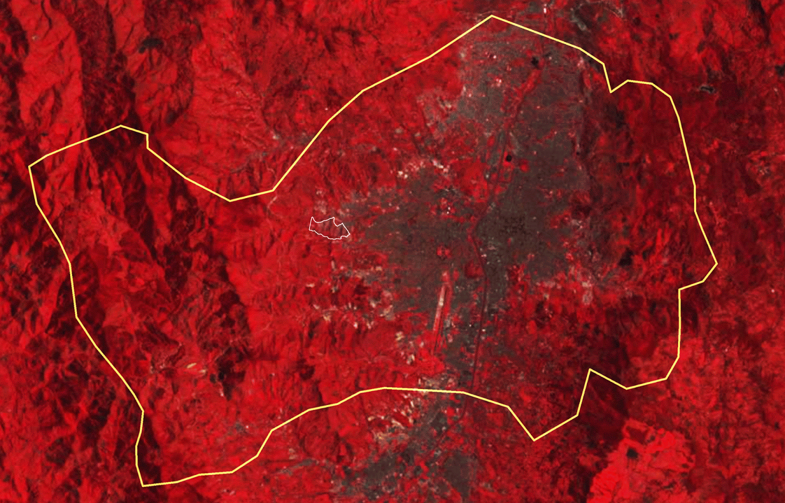
Medellin-LandsatGLS-multispectral-1990-to-2010-false-color “Multispectral Landsat GLS image service created from the Global Land Survey (GLS) data from epochs 1975, 1990, 2000, 2005 & 2010. GLS datasets are created by the United States Geological Survey (USGS) and the National Aeronautics and Space Administration (NASA), using Landsat images.
To understand how areas were changing, we use the AoI measurements to capture their current rate of growth. For the estimation of a settlement area change, we subtracted the area of the last year of measure (ALy) from the area of the first year of measure (AFy). A total of 67% of the sample expanded, 12% had no change, and the rest decreased in size by 21%. The fact that most of the informal settlements are expanding is the most significant finding of the research. The sample has the most representative settlements by city per country; being representative implies some level of consolidation. Researchers deem informal settlements in consolidation states (older settlements) as changing at a lower rate. Change at the consolidation stage happens in the third dimension (added levels to existing structures) (J. Samper 2017). However, our results challenge this previous understanding. To estimate mean percentage growth ( ) of the sample, we subtracted the area of the first year (AFy) from the area of the last year measurement (ALy) and divided that by the difference between the year of first measurement (Fy) and the year of last (Ly). Then we estimated the proportional value of the growth per year (%Gy).

Time change example of the AoI for Sebkha, Nouakchott, Mauritania. Four aerials for the same settlement from 2017, 2002, 2008, and 2002. All image sources from google earth-pro.
Our research found an average percentage growth of 9.8% for the sample in area per year. Growth was not homogeneous across regions. We discovered something expected: regions are expanding at different rates, informal areas in Africa and Latin America are growing more rapidly than those in Asia. Since African cities are going through a period of expansion, finding high rates of growth in informal settlements there is expected. In contrast, Latin America is one of the most urbanized areas of the world with informal settlements in the region dating back a hundred years (Perlman 2010). Accelerated urban growth is not expected in this region. However, the sample reveals a significant number of settlements with exponential growth. Figure 6 shows how the variation among cases in the sample growth correlates to geographical regions. Africa commands a significant number of entries with growth between 4.84% and 27.93% per year among its regions. Growth in Africa is followed by Latin America, where most of the growth happens in South America with a 19.36% rate of growth, on average, in contrast to Central America (including Mexico) and the Caribbean with moderate growth rates of 0.98% and 1.08%, on average, respectively. Some regions in Asia have negative growth rates, such as Eastern Asia, with -1.32% rate on average, to a peak of 4.06% in Western Asia. Asian settlements present the lowest average increase of 2%. For these estimates, we also report standard deviations (SD), which demonstrate the erratic nature of growth and change in informal settlements, with much larger numbers than expected for this measure. The variability of growth is evidenced by the global SD of 49.75, influenced greatly by an SD of 87.9 for the South American portion of the sample and an SD of 98.69 for the Northern Africa portion of the sample, along with other regions of high variability.

Settlements growth over time, Toujoinine Trarza, Mauritania, Mokoko Lagos, Nigeria, Soweto Johannesburg, South Africa, Isla Trinitaria Guayaquil, Ecuador, Ajuro Libertador Caracas, Venezuela, Mandala, Collique Callao, Peru, Cite Soleil Port au Prince, Haiti. Source Atlas of Informality.
In this research, we reveal three critical issues about the changing nature of informal settlements. First that the survey of growth corroborates the idea of informality as an expanding geography. Particularly relevant here is how that rate of growth is more substantial than expected. While it is expected to see community’s consolidation and growth stop at some point, this mapping revealed the contrary: the entire sample continued expanding. The average increase in the sample is 9.85% percent per year. The data revealed significant differences between regions. African regions continue extending at a high rate, along with South America, as expected. Central America and the Caribbean, in contrast, show low expansion rates, similar to some areas in Asia. These findings highlight a great need for emphasis on the changing nature of these places. This rate of expansion gives scholars, practitioners, public officials, and international agencies a sense of urgency regarding the need to better cope with the challenges that these new cities are confronting. Following traditional measures on the scale of informality, such as percentages of the population by national indexes, has given us a sense of relief, but looking at area expansion here has uncovered a less uplifting forecast. The scale of informal settlement urban expansion requires a thoughtful and continued oversight to understand the real extent and evolution of urban poverty globally. We need a more centralized way to evaluate the change in conditions of the global urban poor. Specifically, this research highlights the need to incorporate physical area measurement change of informal settlements as a variable to understand progress on global development goals.

Growth percentages in the Atlas of informality, UN-HABITAT, retrieved from the United Nation’s Millennium Development Goals database. Data are available at: http://mdgs.un.org/.
The entire sample of informal settlements continues to grow at a rate of 9.85% per year.

There are noteworthy differences between the results of the AoI and the UN estimates (UN-HS 2010, 9) . In particular, the rate of expansion in the AoI is larger than the estimated percentages of slum population changes from the UN. An interesting contradiction between the data of the AoI and the data gathered at the regional scale by agencies, such as UN Habitat, is that the AoI consistently shows informal neighborhood expansion, meaning that they continue growing. In contrast, the aggregated data present the population living in slums as reducing as a proportion of the entire population. There could be many reasons for this discrepancy, from the detail in measure to the limitation of the relatively small number of cases in the AoI compared to the estimated total globally. However, it raises questions about the accuracy of these studies and supports the need for further systematic measurements of the global situation of informality.
Climate Change & Informal Settlements

West Point, Monrovia, Liberia from 2002 to 2016.
The analysis shows how there is a clear advantage for informal settlements to expand if they are not surrounded by any boundary, but it also illustrates how surrounding development benefits with respect to other inhibitors (such as topography or bodies of water) the growth of informal settlements within a denser context. Water acts as the biggest inhibitor for expansion. It is in these types of edges where evidence of environmental challenges faced by dwellers in informal settlements face is more pronounced. In the settlement of Mandala in Mumbai, India, encroaching into the abutting mangrove, grew more than 100% until 2009, when the settlement lost approximately 50% of its total area due to slum removal. In West Point, Montserrado, Liberia, for example, ocean erosion is making the settlement lose area towards the west-facing area of the settlement; however, the east side continues growing encroaching into the protected bay. in Ngueli, N’Djamena, Chad the process of growth is not linear; the settlement adds and loses area due to abutting a river. Ngueli’s boundary changes during different seasons. Ngueli continually expands, however, environmental conditions play a crucial role in its rate of growth. During the rainy season, the Chari River flow increases and floods the settlement destroying the most vulnerable housing units. This case creates evidence of how peripheral urbanization throng informal land occupation of environmental sensitive areas is one on the most pressing problems of the Global South (Pimentel Walker and Arquero de Alarcón 2018). In 2012, the settlement was faced with a flood that removed 25% of its total area. Then in the following year again during the dry period, the settlement increased its boundary to expand again by a rate of 6.16%. Cases such as Mandala, Ngueli, and West Point (see figure 7) show the nuances of area coverage change in informal settlements. These cases reveal that at the neighborhood scale, growth is not linear, settlements resilience determines their capacity to continue growing even during events that erode the physical form, be these events of human or natural origin. The mapping of perimeter extensions serves as a tool to create evidence of the challenges and resilience of informal settlements under political pressures and ever-increasing climate fluctuations.

Settlements area variability in the informal settlements for Mandala, Ngueli, and West Point.
Finally, this research only focuses on informal settlements around the world; however, the scale of informality is intertwined with the future of the planet. In the context of current accelerated global population growth is undeniable that having clarity about the path of informal settlements that account for the home of more than a third of the population of all cities is to understand the state of global urbanity. If the forecasting of the proportion of informal settlements dwellers is correct, and by 2050 half of all urban dwellers would live in informal settlements, understanding how that change would happen would be essential data to understand not only the challenges of poverty but the challenges of all global dwellers. We need to start investing more in the understanding and overseeing of the spaces of informality not only because the issue is of the utmost importance for billions of poor, but because the future of the planet depends on it.
References:
-
Amado, Miguel, Francesca Poggi, Adriana Martins, Nuno Vieira, and Antonio Ribeiro Amado. 2018. “Transforming Cape Vert Informal Settlements.” Sustainability 10 (7): 2571.
-
Angeles, Gustavo, Peter Lance, Janine Barden-O’Fallon, Nazrul Islam, A. Q. M. Mahbub, and Nurul Islam Nazem. 2009. “The 2005 Census and Mapping of Slums in Bangladesh: Design, Select Results and Application.” International Journal of Health Geographics 8 (1): 32.
-
ArcGIS. n.d. “Landsat GLS Multispectral.” Accessed September 27, 2017. https://www.arcgis.com/home/item.html?id=472f1e9f630e49ccb88d639543554ef9.
-
Archer, Diane, Chawanad Luansang, and Supawut Boonmahathanakorn. 2012. “Facilitating Community Mapping and Planning for Citywide Upgrading: The Role of Community Architects.” Environment and Urbanization 24 (1): 115–29.
-
Arfvidsson, Helen, David Simon, Michael Oloko, and Nishendra Moodley. 2017. “Engaging with and Measuring Informality in the Proposed Urban Sustainable Development Goal.” African Geographical Review 36 (1): 100–114.
-
Ballesteros, Marife M. 2010. “Linking Poverty and the Environment: Evidence from Slums in Philippine Cities.” Philippine Institute for Development Studies Makati City, Philippines.
-
Barros, Joana, and Fabiano Sobreira. 2002. City of Slums : Self-Organisation across Scales. London: University College, London, Centre for Advanced Spatial Analysis.
-
Bird, Julia, Piero Montebruno, and Tanner Regan. 2017. “Life in a Slum: Understanding Living Conditions in Nairobi’s Slums across Time and Space.” Oxford Review of Economic Policy 33 (3): 496–520.
-
Blei, Alejandro M., Shlomo Angel, Daniel L. Civco, Yang Liu, and Xinyue Zhang. 2018. “Accuracy Assessment and Map Comparisons for Monitoring Urban Expansion: The Atlas of Urban Expansion and the Global Human Settlement Layer.”
-
Burchell, Mark J. 2006. “W (h) Ither the Drake Equation?” International Journal of Astrobiology 5 (3): 243.
-
Chien, Ker-hsuan. 2018. “Entrepreneurialising Urban Informality: Transforming Governance of Informal Settlements in Taipei.” Urban Studies 55 (13): 2886–2902.
-
CIESIN, IFPRI. 2004. “CIAT Global Rural-Urban Mapping Project (GRUMP).” Alpha Version: Population Grids.
-
Davis, Dylan S. 2019. “Object‐based Image Analysis: A Review of Developments and Future Directions of Automated Feature Detection in Landscape Archaeology.” Archaeological Prospection 26 (2): 155–63.
-
Davis, Mike. 2006. Planet of Slums. London; New York: Verso.
-
Dovey, Kim. 2013. “Informalising Architecture: The Challenge of Informal Settlements.” Architectural Design 83 (6): 82–89.
-
Drummond, Didier. 1981. Architectes Des Favelas. Paris: Dunod.
-
Fallatah, Ahmad, Simon Jones, and David Mitchell. 2020. “Object-Based Random Forest Classification for Informal Settlements Identification in the Middle East: Jeddah a Case Study.” International Journal of Remote Sensing 41 (11): 4421–45.
-
Fallatah, Ahmad, Simon Jones, David Mitchell, and Divyani Kohli. 2019. “Mapping Informal Settlement Indicators Using Object-Oriented Analysis in the Middle East.” International Journal of Digital Earth 12 (7): 802–24.
-
Fernandes, Edésio. 2011. Regularization of Informal Settlements in Latin America. Lincoln Institute of Land Policy Cambridge, MA, USA.
-
Fuchs, Martin. 2006. “Slum Als Projekt: Dharavi Und Die Falle Der Marginalisierung.” Mumbai–Delhi–Kolkata. Annäherungen an Die Megastädte Indiens, 47–63.
-
Gevaert, C. M., C. Persello, R. Sliuzas, and G. Vosselman. 2017. “Informal Settlement Classification Using Point-Cloud and Image-Based Features from UAV Data.” ISPRS Journal of Photogrammetry and Remote Sensing 125: 225–36.
-
Gilbert, Alan G. 1998. “The Latin American City.”
-
Gilbert, Alan, and Josef Gugler. 1982. “Cities Poverty and Development: Urbanization in the Third World.”
-
Google. 2020. “What Are the Technical Specifications for Google Imagery? - Google Maps Data Help.” 2020. https://support.google.com/mapsdata/answer/6261838?hl=en.
-
Gram-Hansen, Bradley J., Patrick Helber, Indhu Varatharajan, Faiza Azam, Alejandro Coca-Castro, Veronika Kopackova, and Piotr Bilinski. 2019. “Mapping Informal Settlements in Developing Countries Using Machine Learning and Low Resolution Multi-Spectral Data.” In Proceedings of the 2019 AAAI/ACM Conference on AI, Ethics, and Society, 361–368.
-
Guedes, Jade A. d’Alpoim, Stefani A. Crabtree, R. Kyle Bocinsky, and Timothy A. Kohler. 2016. “Twenty-First Century Approaches to Ancient Problems: Climate and Society.” Proceedings of the National Academy of Sciences 113 (51): 14483–91.
-
Gunter, Ashley William. 2009. “Getting It for Free: Using Google EarthTM and IL WIS to Map Squatter Settlements in Johannesburg.” In Geoscience and Remote Sensing Symposium, 2009 IEEE International, IGARSS 2009, 3:III-388-III–391. IEEE.
-
Habitat, U. N. 2016. “World Cities Report 2016.” UN Habitat: Nairobi, Kenya.
-
Hagen, Erika. 2011. “Mapping Change: Community Information Empowerment in Kibera (Innovations Case Narrative: Map Kibera).” In Innovations: Technology, Governance, Globalization, 69–94. MIT Press.
-
Han, Yiwen, Youngkeun Song, Lindsay Burnette, and David Lammers. 2017. “Spatiotemporal Analysis of the Formation of Informal Settlements in a Metropolitan Fringe: Seoul (1950–2015).” Sustainability 9 (7): 1190.
-
Hansen, Karen Tranberg, and Mariken Vaa. 2004. Reconsidering Informality: Perspectives from Urban Africa. Nordic Africa Institute.
-
Hasan, Arif. 2006. “Orangi Pilot Project: The Expansion of Work beyond Orangi and the Mapping of Informal Settlements and Infrastructure.” Environment and Urbanization 18 (2): 451–80.
-
Hofmann, Peter. 2001. “Detecting Informal Settlements from IKONOS Image Data Using Methods of Object Oriented Image Analysis-an Example from Cape Town (South Africa).” Jürgens, C.(Ed.): Remote Sensing of Urban Areas/Fernerkundung in Urbanen Räumen, 41–42.
-
Hofmann, Peter, Josef Strobl, Thomas Blaschke, and Hermann Kux. 2008. “Detecting Informal Settlements from QuickBird Data in Rio de Janeiro Using an Object Based Approach.” In Object-Based Image Analysis, 531–53. Springer.
-
Huang, J., X. X. Lu, and J. M. Sellers. 2007. “A Global Comparative Analysis of Urban Form: Applying Spatial Metrics and Remote Sensing.” LANDSCAPE AND URBAN PLANNING 82 (4): 184–97.
-
Huchzermeyer, Marie. 2004. Unlawful Occupation : Informal Settlements and Urban Policy in South Africa and Brazil. Trenton, NJ: Africa World Press.
-
Huchzermeyer, Marie., Karam, Aly.,. 2006. Informal Settlements : A Perpetual Challenge? Cape Town: UCT Press.
-
Hurskainen, P., and P. Pellikka. 2004. “Change Detection of Informal Settlements Using Multi-Temporal Aerial Photographs–the Case of Voi, SE-Kenya.” In Proceedings of the 5th African Association of Remote Sensing of the Environment Conference, Nairobi, Kenya, Unpaginated CD-ROM.
-
Ioannidis, Charalabos, Christodoulos Psaltis, and Chryssy Potsiou. 2009. “Towards a Strategy for Control of Suburban Informal Buildings through Automatic Change Detection.” Computers, Environment and Urban Systems 33 (1): 64–74.
-
Jones, Paul. 2017. “Formalizing the Informal: Understanding the Position of Informal Settlements and Slums in Sustainable Urbanization Policies and Strategies in Bandung, Indonesia.” Sustainability 9 (8): 1436.
-
Joshi, Pratima, Srinanda Sen, and Jane Hobson. 2002. “Experiences with Surveying and Mapping Pune and Sangli Slums on a Geographical Information System (GIS).” Environment and Urbanization 14 (2): 225–40.
-
Kamalipour, Hesam. 2016. “FORMS OF INFORMALITY AND ADAPTATIONS IN INFORMAL SETTLEMENTS.” ArchNet-IJAR 10 (3).
-
———. 2020. “Improvising Places: The Fluidity of Space in Informal Settlements.” Sustainability 12 (6): 2293.
-
Kamel, Nabil, Vinit Mukhija, and Anastasia Loukaitou-Sideris. 2014. “Learning from the Margin: Placemaking Tactics.” The Informal American City: Beyond Taco Trucks and Day Labor, 119.
-
Kennett, Douglas J., and James P. Kennett. 2006. “Early State Formation in Southern Mesopotamia: Sea Levels, Shorelines, and Climate Change.” Journal of Island & Coastal Archaeology 1 (1): 67–99.
-
Kibwana, Kivutha. 2000. “Spontaneous Settlement and Environmental Management.” Essays on Land Law: The Reform Debate in Kenya, 105–36.
-
Kihato, Caroline Wanjiku, Lauren Royston, José Alberto Raimundo, and Inês Macamo Raimundo. 2013. “Multiple Land Regimes: Rethinking Land Governance in Maputo’s Peri-Urban Spaces.” In Urban Forum, 24:65–83. Springer.
-
Kuffer, Monika, and Joana Barrosb. 2011. “Urban Morphology of Unplanned Settlements: The Use of Spatial Metrics in VHR Remotely Sensed Images.” Procedia Environmental Sciences 7: 152–57.
-
Kuffer, Monika, Karin Pfeffer, and Richard Sliuzas. 2016. “Slums from Space—15 Years of Slum Mapping Using Remote Sensing.” Remote Sensing 8 (6): 455.
-
Kuffer, Monika, Karin Pfeffer, Richard Sliuzas, and Isa Baud. 2016. “Extraction of Slum Areas from VHR Imagery Using GLCM Variance.” IEEE Journal of Selected Topics in Applied Earth Observations and Remote Sensing 9 (5): 1830–40.
-
Lasaponara, Rosa, and Nicola Masini. 2012. Satellite Remote Sensing: A New Tool for Archaeology. Vol. 16. Springer Science & Business Media.
-
Leeds, Anthony. 1971. The Significant Variables Determining the Character of Squatter Settlements. University of Texas, Institute of Latin American Studies.
-
Loureiro, V., V. Medeiros, and MARIA ROSÁLIA Guerreiro. 2017. “Configuration of Self-Organizing Informality: Socio-Spatial Dynamic in Favelas.” In 11th International Space Syntax Symposium, 1–17. Instituto Superior Técnico, Departamento de Engenharia Civil, Arquitetura e Georrecursos, Portugal.
-
Mayunga, S. D., D. J. Coleman, and Y. Zhang. 2007. “A Semi‐automated Approach for Extracting Buildings from QuickBird Imagery Applied to Informal Settlement Mapping.” International Journal of Remote Sensing 28 (10): 2343–57.
-
Mboga, Nicholus, Claudio Persello, John Ray Bergado, and Alfred Stein. 2017. “Detection of Informal Settlements from VHR Satellite Images Using Convolutional Neural Networks.” In 2017 IEEE International Geoscience and Remote Sensing Symposium (IGARSS), 5169–5172. IEEE.
-
Mehrotra, Rahul. 2009. “Kinetic City. Issues for Urban Design in South Asia.” Reclaiming (the Urbanism of) Mumbai. Explorations in/of Urbanism. Sun Publishers, Amsterdam, 142–52.
-
Mesa Sánchez, Nora Elena. 1985. “Proceso de Desarrollo de Los Asentamientos Populares No Controlados: Estudios de Caso Medellín, Colombia.”
-
Mukhija, Vinit, and Anastasia Loukaitou-Sideris. 2014. The Informal American City: Beyond Taco Trucks and Day Labor. MIT Press.
-
Mundial, Banco. 2018. “World Development Indicators (WDI).” Recuperado de Http://Databank. Worldbank. Org/Ddp/Home. Do.
-
Niebergall, Susan, Alexander Loew, and Wolfram Mauser. 2008. “Integrative Assessment of Informal Settlements Using VHR Remote Sensing Data—the Delhi Case Study.” IEEE Journal of Selected Topics in Applied Earth Observations and Remote Sensing 1 (3): 193–205.
-
OECD. 1997. “OECD Glossary of Statistical Terms - Informal Settlements Definition.” 1997. https://stats.oecd.org/glossary/detail.asp?ID=1351.
-
Oxford, Dictionary. 2000. Oxford Advanced Learner’s Dictionary. Oxford University Press Oxford.
-
Patel, A., A. Crooks, and N. Koizumi. 2012. “Simulating Spatio-Temporal Dyanmics of Slum Formation in Ahmedabad, India.” In .
-
Perlman, Janice E. 2010. Favela : Four Decades of Living on the Edge in Rio de Janeiro. Oxford; New York: Oxford University Press.
-
Pimentel Walker, Ana Paula, and María Arquero de Alarcón. 2018. “The Competing Social and Environmental Functions of Private Urban Land: The Case of an Informal Land Occupation in São Paulo’s South Periphery.” Sustainability 10 (11): 4160.
-
Purwanto, Edi, Agung Sugiri, and Rony Novian. 2017. “Determined Slum Upgrading: A Challenge to Participatory Planning in Nanga Bulik, Central Kalimantan, Indonesia.” Sustainability 9 (7): 1261.
-
Rambaldi, Giacomo, Peter A. Kwaku Kyem, Mike McCall, and Daniel Weiner. 2006. “Participatory Spatial Information Management and Communication in Developing Countries.” The Electronic Journal of Information Systems in Developing Countries 25 (1): 1–9.
-
Roy, Ananya., and Nezar. AlSayyad. 2004. Urban Informality : Transnational Perspectives from the Middle East, Latin America, and South Asia. Lanham, Md.; Berkeley, Calif.: Lexington Books ; Center for Middle Eastern Studies, University of California at Berkeley.
-
Rüther, Heinz, Hagai M. Martine, and E. G. Mtalo. 2002. “Application of Snakes and Dynamic Programming Optimisation Technique in Modeling of Buildings in Informal Settlement Areas.” ISPRS Journal of Photogrammetry and Remote Sensing 56 (4): 269–82.
-
Samper, Jose Jaime. 2014. “Physical Space and Its Role in the Production and Reproduction of Violence in the ‘Slum Wars’ in Medellin, Colombia (1970s-2013).” /z-wcorg/.
-
Samper, Jota. 2016. “Urban Upgrading in a Context of Violence: Perceptions of Security and Physical Space in the Case of the Favela-Bairro in Rio de Janeiro.” International Relations and Diplomacy 4 (12): 760–78.
-
———. 2017. “Eroded Resilience, Informal Settlements Predictable Urban Growth Implications for Self-Governance in the Context of Urban Violence in Medellin, Colombia.” UPLanD-Journal of Urban Planning, Landscape & Environmental Design 2 (2): 183–206.
-
———. 2020. “Atlas of Informality.” Atlas of Informality. 2020. www.atlasofinformality.com.
-
Saunders, Doug. 2011. Arrival City: How the Largest Migration in History Is Reshaping Our World. Vintage.
-
Schubert, Dirk. 2009. “Der Größte Slum Asiens: Dharavi (Mumbai)–Von Fehlschlägen Der „Sanierung “zum Modellprojekt.” Arbeitskreis Stadterneuerung Und Institut Für Stadt-Und Regionalplanung (Eds.), Megacities Und Stadterneuerung. Jahrbuch Stadterneuerung, 99–114.
-
Shabat, Abuobayda M., and Jules-Raymond Tapamo. 2017. “A Comparative Study of the Use of Local Directional Pattern for Texture-Based Informal Settlement Classification.” Journal of Applied Research and Technology 15 (3): 250–58.
-
Shekhar, Sulochana. 2012. “Detecting Slums from Quick Bird Data in Pune Using an Object Oriented Approach.” International Archives of the Photogrammetry, Remote Sensing and Spatial Information Sciences 39 (8): 519–24.
-
Singh, H. H., and V. K. Kumra. 1986. “Slums: Threat to Urban Environment.” Geography and Environment: Issues and Challenges, 113–38.
-
Sliuzas, R., G. Mboup, and A. de Sherbinin. 2008. “Report of the Expert Group Meeting on Slum Identification and Mapping.” Report by CIESIN, UN-Habitat, ITC 36.
-
Stasolla, Mattia, and Paolo Gamba. 2008. “Spatial Indexes for the Extraction of Formal and Informal Human Settlements from High-Resolution SAR Images.” IEEE Journal of Selected Topics in Applied Earth Observations and Remote Sensing 1 (2): 98–106.
-
Stow, D., A. Lopez, C. Lippitt, S. Hinton, and J. Weeks. 2007. “Object‐based Classification of Residential Land Use within Accra, Ghana Based on QuickBird Satellite Data.” International Journal of Remote Sensing 28 (22): 5167–73.
-
Tarolli, Paolo, Wenfang Cao, Giulia Sofia, Damian Evans, and Erle C. Ellis. 2019. “From Features to Fingerprints: A General Diagnostic Framework for Anthropogenic Geomorphology.” Progress in Physical Geography: Earth and Environment 43 (1): 95–128.
-
Taubenböck, Hannes, and N. J. Kraff. 2014. “The Physical Face of Slums: A Structural Comparison of Slums in Mumbai, India, Based on Remotely Sensed Data.” Journal of Housing and the Built Environment 29 (1): 15–38.
-
Taubenböck, Hannes, Nicolas J. Kraff, and Michael Wurm. 2018. “The Morphology of the Arrival City-A Global Categorization Based on Literature Surveys and Remotely Sensed Data.” Applied Geography 92: 150–167.
-
UN, Development Indicators Unit. 2015. “Unstats | Millennium Indicators.” Millennium Development Goals Indicators. 2015. http://mdgs.un.org/unsd/mdg/SeriesDetail.aspx?srid=710.
-
UN-Habitat. 2003. The Challenge of Slums : Global Report on Human Settlements, 2003. London; Sterling, VA: Earthscan Publications.
-
UN-Habitat, United Nations Human Settlements. 2006. The State of the World’s Cities 2006/2007: The Millennium Development Goals and Urban Sustainability: 30 Years of Shaping the Habitat Agenda. Vol. 3. Routledge.
-
UN-HS, United Nations Human Settlements Programme. 2010. State of the World’s Cities 2010/2011: Bridging the Urban Divide. Earthscan.
-
United Nations. 2017. “Progress towards the Sustainable Development Goals.” https://unstats.un.org/sdgs/files/report/2017/secretary-general-sdg-report-2017--EN.pdf.
-
———. 2018. 2018 Revision of World Urbanization Prospects. United Nations New York.
-
———. 2019. “The Sustainable Development Goals Report 2019.” United Nations. https://brasilnaagenda2030.files.wordpress.com/2019/09/the-sustainable-development-goals-report-2019.pdf.
-
Werlin, Herbert. 2000. “The Slum Upgrading Myth.” Sage Urban Studies Abstracts 28 (1).
-
Werthmann, Christian, and John Beardsley. 2011. “Improving Informal Settlements - Ideas from Latin America | David Rockefeller Center for Latin American Studies.” 2011. http://www.drclas.harvard.edu/brazil/news/designmag.
-
Williams, Nathaniel, Duncan Quincey, and John Stillwell. 2016. “Automatic Classification of Roof Objects from Aerial Imagery of Informal Settlements in Johannesburg.” Applied Spatial Analysis and Policy 9 (2): 269–81.
-
World Bank. 2015. “Population Living in Slums (% of Urban Population).” https://data.worldbank.org/indicator/EN.POP.SLUM.UR.ZS.
-
Wurm, M., H. Taubenböck, M. Weigand, and A. Schmitt. 2017. “Slum Mapping Based on Multi-Scale Texture Features in Polarimetric SAR Data.” Remote Sensing of Environment 194: 190–204.
-
Zamora, Hernán Antonio. 2017. “CABA: Cartografía de Los Barrios de Caracas. 1966-2014. VVAA.” BAc Boletín Académico. Revista de Investigación y Arquitectura Contemporánea 7: 193–94.
-
Zetter, Roger, and Flavio AM De Souza. 2000. “Understanding Processes of Informal Housing: Appropriate Methodological Tools for a Sensitive Research Area.” International Planning Studies 5 (2): 149–64.